Latitude and Longitude
|
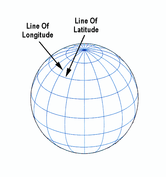
Latitude: We all picture the earth as a sphere that has axis around which it spins. The ends of the axis are the North and South Poles. The Equator is a line around the earth, an equal distance from both poles. The Equator is also the latitude line given the value of 0 degrees. A line connecting all the points with the same latitude value is called a line of latitude. This term is usually used to refer to the lines that represent values in whole degrees.
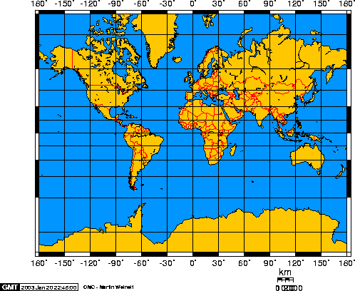
Longitude: Lines of longitude, called meridians, run perpendicular to lines of latitude, and all pass through both poles. Each longitude line is part of a great circle. There is no obvious 0-degree point for longitude, as there is for latitude. Throughout history many different starting points have been used to measure longitude. Mercator Projection: Map projections are attempts to portray the surface of the earth or a portion of the earth on a flat surface. Some projections minimize distortions in some of these properties at the expense of maximizing errors in others. Some projection are attempts to only moderately distort all of these properties. |
